")
")

INCLIS-30 DEVIATION Probe
DEVIATION probe INCLIS-30 for geophysical investigations with this instrument it is possible to make an accurate 3D survey of the borehole deviation.
INCLIS-30
Deviation Probe
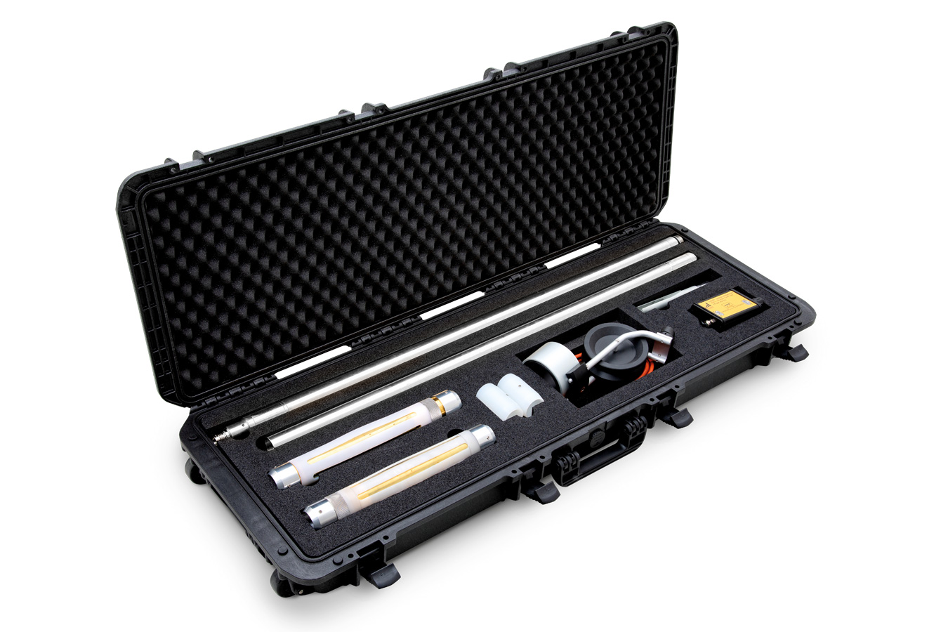
The new probe Inclis DH-30, designed and manufactured by Solgeo, allows to realize a 3D inclinometer survey of holes (e.g. perforations) having any direction and inclination in space.
The probe contains a magnetometric triad and an accelerometric triad; in situations where the metallic coatings of the perforation can disturb the magnetometric sensors, the probe is equipped with a support and pointing system by means of guide rods.
Product plus
- allows to perform a 3D borehole deviation survey
- 3 magnetometric and 3 accelerometric sensors
- 360° orientation range
Applications
- Seismic soil characterization
- Verification treatment jet-grouting
- Identification of cavities
- Calculation of elastic modules
Civil
Foundation
works
works
Characterization
of soils and rock masses
of soils and rock masses
Details
INCLIS-DH could be provided with a battery powered wifi connected cable drum and an 8” tablet with dedicated Solclino app allowing an immediate return of the results and graphs with the planialtimetrico trends of the hole.
INCLIS-DH can also be provided with a standard cable drum and USB connection box that provides both power and real-time data transfer to a person- al computer.
INCLIS-DH can also be provided with a standard cable drum and USB connection box that provides both power and real-time data transfer to a person- al computer.
Technical Characteristics
Probe characteristics
| Dimensions | 2000 mm length x 30 mm diameter |
| Weight | 4,1kg, 20 kg (with suitcase) |
| Operating temperature range | -25 / +85° C |
| Connector | Souriau 200 bar ip69 |
| Enclosure material | Stainless steel |
| Digital output | Rs422 (usb adapter provided) |
| Orientation range | 0÷180° inclination 0°-360° azimuth |
| Accuracy | +/- 0,2° roll and inclinatio; +/- 0,5° Azimut |
| Digital output rate/logging rate | Fino a 5 Hz |
| Output models | Acceleration and magnetic field vectors; orientation angles; temperature |
Usb version
| Communication | Provided usb to rs422 adapter |
| Application software | Running on pc with win10 os |
Drum characteristics
| Cable length | 60 m (other length on request) |
| Operating temperature range | -20 / 60° C Da 0 a 45°C during charge |
| Communication | Integrated wifi hotspot |
| Led indicators | Battery level, charge |
| Battery | 3,7V Li-ion, 3600mAh. |
| Autonomy | Up to 10 hours |
| Charging time | 4 hours |
Tablet characteristics
| Display size | Android, 8” display size. |
Gallery